 BGS Data Catalogue
Climate change
Type of resources
Topics
Keywords
Contact for the resource
Provided by
Years
Formats
Representation types
Update frequencies
Scale
-

Includes XRF elemental abundance data, LECO data, organic geochemical data (GC-MS), and os-isotope and associated Re and Os abundance data. Geographical area - primarily France (Paris and Voncontian Basin), UK (Yorkshire coast), and Japan (Toyora area, Yamaguchi Prefecture). Also includes globally distributed palaeotemperature data.
-

Published papers for NERC grant NE/I020571/2. Grant award abstract: How does the Earth's climate recover from events of rapid and extreme global warming or cooling? Why have the huge fluctuations in atmospheric CO2 in the geological past not caused runaway climate effects, making the Earth become Venus- or Mars-like? Silicate weathering of the continents is the main CO2 removal process, and therefore a dominant long-term climate control mechanism. However the debate on what controls silicate weathering, and therefore atmospheric CO2, is still contentious and ongoing. A correct understanding of the controls on weathering, and its link to atmospheric CO2 levels is critical, because 1) it is possible that weathering is the process that has kept Earth's climate in the relatively narrow bounds required for life over the past several hundred million years; 2) it is impossible to decipher the causes and consequences of long-term climate variations through Earth's history without accurate weathering data, which in turn impacts on our understanding of current climate; 3) comprehension of climate systems leads to more accurate modelling of future climate change; 4) rapid global climate change inevitably leads to large mass extinctions. Therefore it is important to unravel the link between extinctions and the Earth's climate systems, including CO2 control. Lithium isotopes have gained much interest over the past few years because large variations in the Li isotope ratio in rivers and clays are caused by silicate weathering processes. Furthermore, unlike tracers of weathering used previously, Li isotopes also respond to the intensity of weathering, and therefore can be linked directly to weathering rates. This is critical, because for the first time is gives us a window into the variation of weathering rates through time, which in turn means we can use the Earth's past climate variations as a natural laboratory. Three of the largest climate fluctuations and mass extinctions in Earth's history will be examined and modelled, primarily using Li isotopes, but also several other tracers, which will serve to reveal information on marine and volcanic conditions at the time. These geological periods (the end-Ordovician glaciation (450 Ma (million years ago)), the Permo-Triassic event (251 Ma) and the Cenomanian-Turonian Ocean Anoxic Event (94 Ma)), represent times when rapid warming or cooling of Earth's climate occurred, resulting in the extinction of up to 90% of life on Earth. Samples from these time periods exist in the form of marine calcium carbonate. This was precipitated (either inorganically, or via various life forms) in the oceans at the time, and provides a record of ocean chemistry, which in turn is directly linked to the atmospheric conditions. Analysing Li isotopes is a complex procedure, and will be undertaken at Oxford University. Collaborations will exist with Prof. Jan Veizer (Ottawa University) and Dr. Christoph Korte (Copenhagen University), who are specialists in the studied time periods, with Prof. Andy Ridgwell (Bristol University), who is an expert climate modeller, and with Prof. David Harper, who is an expert in mass extinctions. By understanding weathering and climatic responses to periods of rapid global warming and cooling we will gain critical information on Earth's climate feedbacks, and on processes that led to the extinction of vast proportions of the biosphere.
-

Published paper associated with NERC grant NE/F011091/1. Price, G.D., Twitchett, R.J., Wheeley, J.R., Buono, G. 2013. Isotopic evidence for long term warmth in the Mesozoic. Scientific Reports, 3, 1438. doi: 10.1038/srep01438
-

2 examples of Integrated Water Vapour Transport (IVT) maps generated using a new algorithm produced from the work done under the Grant. This algorithm has been published and the article can be found here: http://onlinelibrary.wiley.com/doi/10.1029/2012JD018027/abstract
-
General circulation model (HadCM3) output of the study by Matero et al. (2017) “The 8.2 ka cooling event caused by Laurentide ice saddle collapse. Data has been processed into netCDF4 - timeseries, and includes the following variables at model resolution: ocean temperature, ocean salinity, precipitation, air temperature at 2m height, depth of the oceanic mixed layer, sea ice concentration and meridional overturning circulation strength. The atmosphere component of the model has a horizontal resolution of 2.5° x 3.75° with 19 unevenly spaced vertical layers. The ocean component has a horizontal resolution of 1.25° x 1.25° with 20 unevenly spaced vertical layers. For more information see published paper, https://doi.org/10.1016/j.epsl.2017.06.011
-
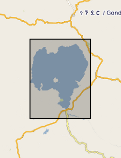
Zr/Rb, Ca/Ti, Rb/K ratios against depth (0.112 m to 62.686 m) and age ( 366 to 150190 yrs). NERC grant, NE/D012996/1, abstract Lake Tana, in the highlands of northern Ethiopia, is the source of the Blue Nile, one of the world's great rivers. Surprisingly, very little is known about the age and history of this lake: one estimate from the 1930's is that it was formed 10,000 years ago by a lava dam. Similarly, little is known about the climatic history of the wider region that comprises the Blue Nile headwaters, despite the fact that the Nile has long been recognized as critical to the resources of ancient and modern Egypt. New geophysical and core data, obtained by us in October 2003 and September 2004 with NERC support, show that the lake may be at least 40,000 years old. Our new data also show that the lake dried out at around 16,000 years ago, and almost certainly at apparently regular intervals during the later stages of the last Ice Age. It is possible that the lake dried because of intense droughts lasting one or two hundred years, and that the droughts were caused by disruption of Africa's monsoon climate when iceberg-laden meltwater from North America flooded the North Atlantic - the Heinrich events. In this new PalaeoTana Project, we aim to test these hypotheses by drilling a sediment core, up to 100m in length, from the northern basin of Lake Tana, in about 10m water depth, and about 2km from shore. The core will be scanned at high resolution using X-ray fluorescence, X-ray and colour imagery, geophysical and magnetic core-scanning technology, without damaging the sedimentary components. The resulting datasets will identify past desiccation events, which will be investigated in detail and interpreted by comparison to sediments of the known drying-out event at 16,000 years ago. Dating the sediments by appropriate methods including luminescence, tephrochronology, and Argon-Argon dating will allow precise estimates of the timing and duration of the drought events. The relative timing of these events in comparison with abrupt climatic events in ocean cores (especially Heinrich events), and in other continental records, will allow inferences about the global- scale mechanisms of abrupt climate change. The data can also be used to test climate models, and thus to help judge the accuracy of model-predicted abrupt climate change in the future. A long core record of past climate and environment from this part of Africa would have major significance for understanding both regional environmental change, because of the influence of the Nile on NE Africa and the eastern Mediterranean, and global climate. It will contribute to understanding how future changes in ocean temperature and circulation will affect global climate, especially in the heavily populated monsoon regions of Africa and Asia. It will also have significance for understanding the later stages of human evolution in and dispersal out of Africa, by providing a record of the environmental changes that influenced early human populations and their water, plant and hunting resources.
-

These data were produced within the objectives of the NERC grant (alongside collaborator Gibbs at NOC, Southampton) and predominantly comprise biometric data collected under light microscope at x1500 magnification from the coccolithophore taxon Coccolithus pelagicus, a heavily calcified taxon with a long fossil record. The data was collected as part of a collaborative research effort bringing together the modern and fossil consortia within the UK Ocean Acidification research programme. The data are from batch culture experiments on both modern sub-species of C. pelagicus and provide cell size, coccosphere size, coccolith size and number of coccoliths per cell. The same parameters were measured from C. pelagicus from North Atlantic field and sediment trap samples from inside and outside bloom conditions. Again, the same parameters were also measured from C. pelagicus from exceptionally well-preserved fossil material from several shelf and off-shelf marine locations including New Jersey, Tanzania, California and the Bay of Biscay.
-

These data are described fully in the following publication: S. Barker, J. Chen, X. Gong, L. Jonkers, G. Knorr, D. Thornalley, Icebergs not the trigger for North Atlantic cold events. Nature 520, 333-336 (2015). The dataset comprises planktonic foraminiferal census counts and counts of Ice Rafted Debris (IRD) from sediment samples collected during Ocean Drilling Programme (OPD) leg 162 site 983 in the Northeast Atlantic (60.48°N, 23.68°W, 1,984m water depth). The data were collected between Jan 2011 and Dec 2014. The dataset includes values every 2cm from 2 to 51.5m (metres composite depth) along the ship-board splice. Before counts were performed bulk sediments were spun overnight in distilled water, before sieving over a 63µm sieve. All portions were dried, weighed and stored. Counts were performed on a split of the >150µm fraction. The dataset can be employed to assess changes in surface temperature and presence of rafted ice over the site over the past 440kyr or so. This information is of interest to paleoceanographers and paleoclimatologists. The dataset was created and interpreted by a team at Cardiff University, with additional input from other authors named in the publication. The dataset is complete except for one or two samples that were not received from the repository.
-
The data are the gridded recharge values obtained from the BGS distributed recharge model (ZOODRM) driven by 11 Ensembles of the HaDCM3 Regional Climate Model (RCM) taken from the Future Flow and Groundwater Level data set (http://www.ceh.ac.uk/our-science/projects/future-flows-and-groundwater-levels). The model covers the mainland areas of England, Scotland and Wales. The 11 ensembles are run from January 1950 to December 2099. The dataset themselves are the gridded (2 km by 2 km) outputs from the recharge model averaged over four time horizons: historical, 20s, 50s, and 80s, for each of the 11 ensembles. The results can be used to assess the impact of climate change on potential recharge (soil drainage) for catchments in mainland England, Scotland and Wales.
-
Shrink-swell is recognised as the most significant geohazard across Great Britain. This dataset identifies areas of shrink-swell hazard with increased potential due to changing climatic conditions based on forecasts derived from the UKCP09 research project. The dataset has been created at two levels of detail for different climatic scenarios and dates up to 2080. The Basic dataset is an overview at 2Km grid resolution whilst the more detailed Premium dataset is generated at a 50m resolution. The Open versions are simplified versions of the premium versions and are shared via GeoIndex. The premium versions are paid for products. UKCP09 - UK Climate Projections 2009 project